


Blum Center Drones to Enhance Flood Resilience
Help us fund and operate a fleet of low-cost aerial surveying drones, which we can deploy to settlements in developing countries at high risk of flooding.
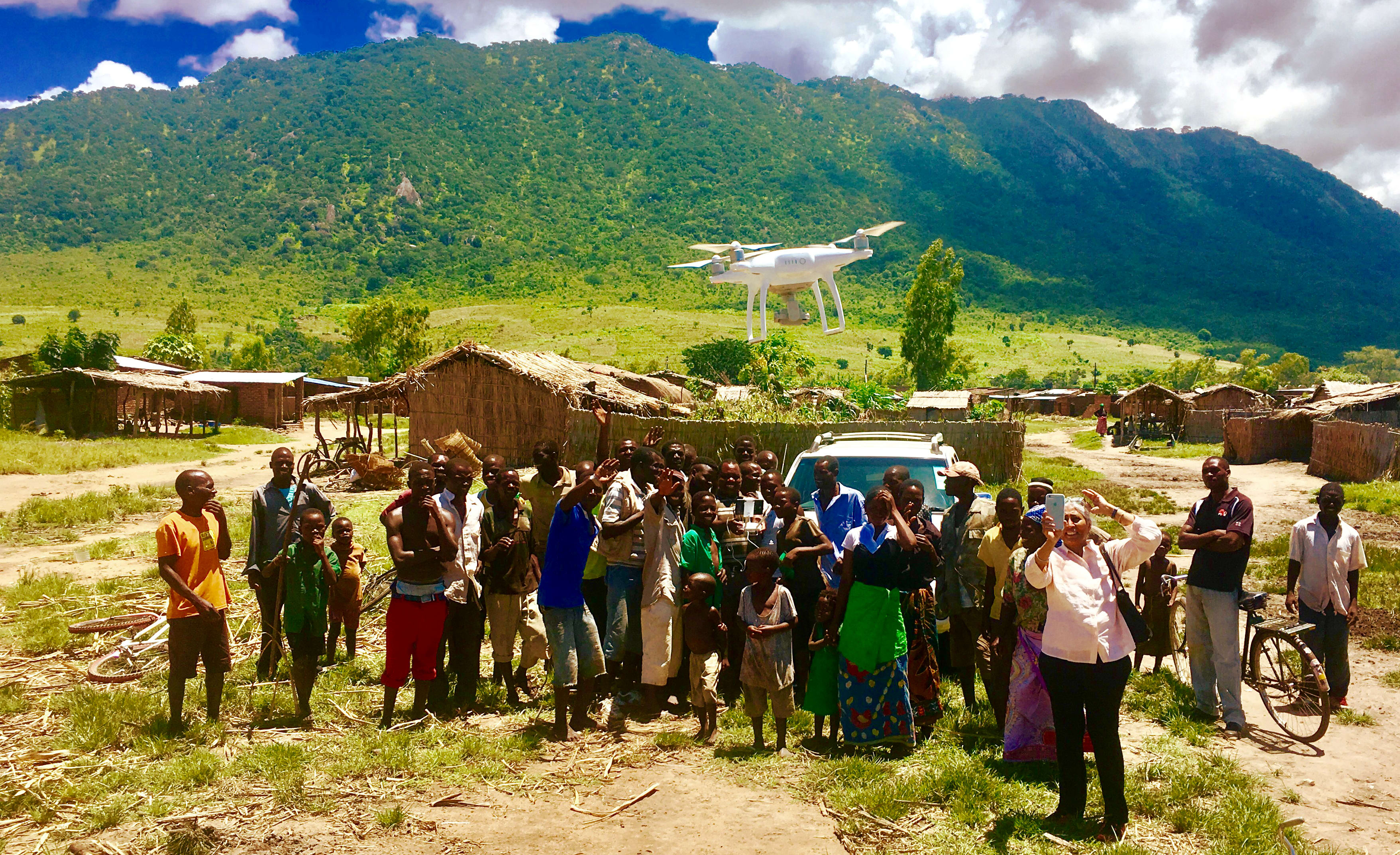
Drones can be used as very cost effective mapping devices, gathering fine resolution data on a site's terrain, landcover, and even its infrastructure. This information is necessary to build models capable of predicting flood hazard at scales of streets and individual homes. Especially in developing countries, where impacts of flooding can be the most devastating, data for flood hazard modeling has traditionally not been available due to its high cost. Each drone costs approximately US$2,000 and mapping a 100 sq km urban settlement can cost between US$10,000-20,000, while traditional aerial laser scanning surveys can cost over $50,000 for the same area depending on proximity to the nearest airport. Drones are simple to deploy, easy to transport, and built-in powerful cameras offer the ability to map settlements' terrain topography and infrastructure at a fraction of the cost compared to traditional mapping methods, opening up the possibility for detailed flood modeling in developing countries where the need is at its greatest.
The funds raised will be used to establish and operate a fleet of drones which can be deployed to locations where flood hazard modeling can greatly benefit local communities in developing countries. The drones will map settlements at risk of flooding one square kilometer at a time, building the required datasets to establish detailed flood hazard models that the local population will be trained to use. In particular, communities will be able to identify vulnerable coastal areas, or test how low-cost green infrastructure technologies like rain tanks and rain gardens can be strategically positioned across watersheds to capture rainfall runoff that currently leads to flooding. We currently have two sites where we have commenced drone mapping, La Paz (Mexico) and Zomba (Malawi), but are lacking the drone numbers and the man power to speed up data processing. Furthermore we would like to expand our operational capabilities to other locations with severe flood hazard including South America and Asia.
The data gathered by the drones will be used to create flood hazard maps tailored to each community's needs, and will allow to test effective strategies relying on low-cost green infrastructure technologies to mitigate the settlement's risk to flooding and increase its resilience under changing climate conditions.
Floods are the most destructive of natural disasters, on average affecting 100 million people globally.
They claim lives, damage properties, destroy crops, decimate livestock, and can lead to deteriorating health due to waterborne diseases and malnutrition. A World Bank study found that in countries accounting for nearly three quarters of the global population, poverty is correlated with flood exposure. Especially in cities in Asia, Africa, and South America, rapid population growth is forcing some of the poorest residents into floodplain settlements where the risk of flooding is already elevated. By the year 2080 it is projected that the world's population exposed to river and coastal flooding will double due to continued population growth, intensification of rainfall, and sea level rise. In South American countries flooding is already leading to political instabilities, and as the world's population affected by chronic and extreme flooding increases large scale migration patterns are likely to occur.
Flood hazard modeling can be used to visualize how flooding can affect settlements under current and future climate conditions, and can be used to design mitigation methods, evacuation procedures, and adaptation strategies to increase the resilience of communities in those settlements. Flood models require extensive high quality datasets to produce accurate predictions, and traditionally the cost of acquiring those datasets has been beyond the means of developing nations which can benefit the most from those models.
About the UCI Blum Center for Poverty Alleviation
The Blum Center acts as a platform, harnessing the passion, ingenuity, and knowledge of students, faculty, and staff at UCI, around understanding and addressing the complex challenges of poverty and inequality in the 21st century.
Researchers at the Blum Center are implementing a new paradigm where the most powerful environmental modeling tools on the planet are put in the hands of local communities. This grass-roots approach to disaster management is built upon a foundation of community engagement, framed by an understanding of what communities care most about, and implemented to co-produce actionable knowledge that is useful and usable by everyone in the community.
$50
Propellers and More
$50 will help us buy the separate mechanical parts that make up the drone. Thank you for your gift!
$200
Flying Champion
Thank you for your generosity! This money will help us buy batteries, software, and other essential parts for our drone.
$500
Co-pilot
Thanks to you, we are a quarter of the way to purchasing one drone to help flood resilience in the areas that need it most!
$1,000
Visionary
This will bring us halfway to purchasing one drone that will help save lives in Asia, Africa, and South America. Thank you!
$2,000
Drone Complete
You've equipped us to purchase a complete drone. On behalf of the Blum Center, thank you for your incredible generosity. Your help will enable us to design mitigation methods, evacuation procedures, and adaptation strategies to increase the resilience of communities in those settlements that need it most.
